
Newberg Street Search Workflow
Yamhill County’s public route begins with the Ascend Property Search. Enter a street address, then save the account or tax-lot result before opening the map. The County gives three address examples: Main, 123 Main St, and 123% Main. The percent sign works as a wildcard between a number and street name. City, state, and ZIP fields can narrow a common street, but the street-address field is required for this route. Most search fields need at least three characters, while an account number needs two.
A careful Newberg address search has five stages. Each stage changes the question from an address match to a documented property trail.
- Search the address in Ascend and record the returned assessment account or map tax lot.
- Open that parcel in the GIS tax-lot layer to compare the situs address, assessed owner field, and separate tax-mailing field.
- Use the tax-lot map, plat context, or property summary to find the legal description needed for Clerk land records.
- Search the recorded-document route or ask the Clerk’s lobby staff for the transfer document using the legal description and deed clues.
- For a past address listing, compare the relevant directory or phone-book year rather than treating it as a current roster.
The Ascend landing form shows the account and property-address paths that begin the address search.
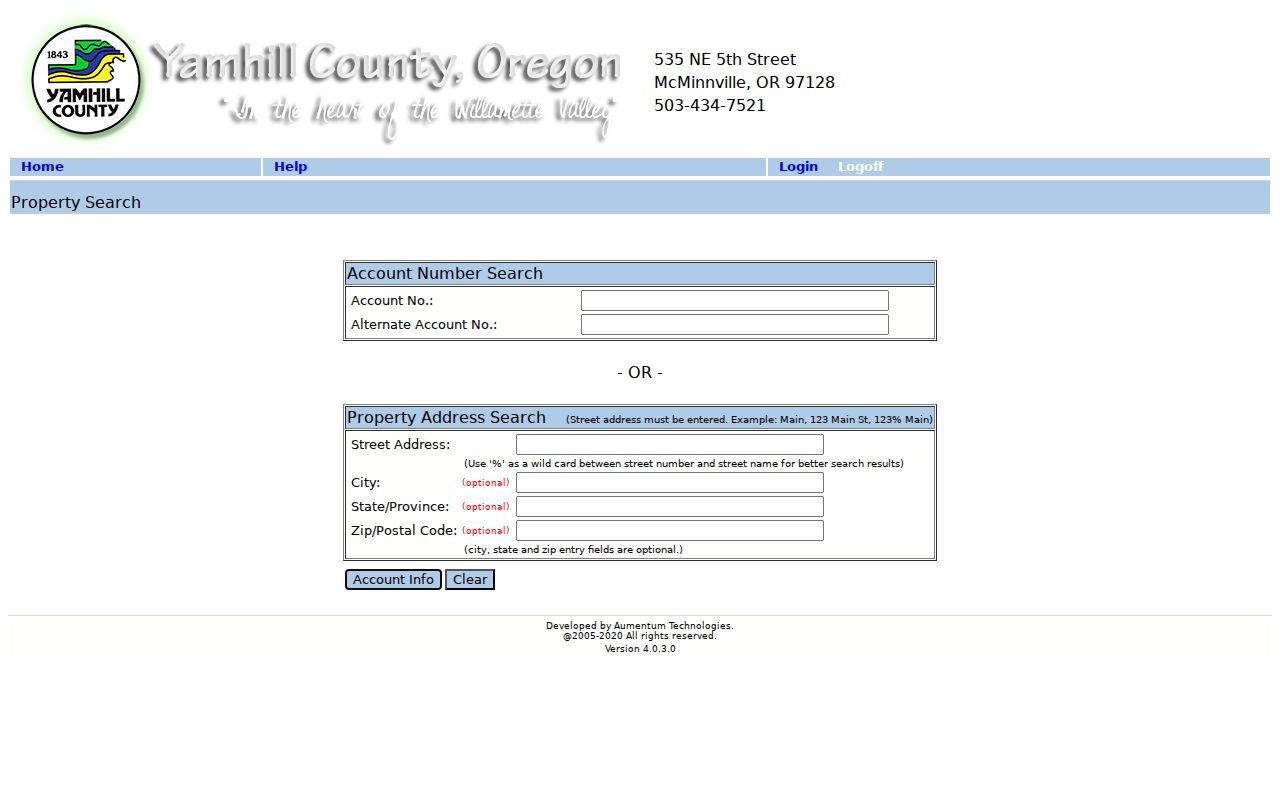
Its exposed form does not offer an owner-name field or a public whole-street roster. Partial address searching and GIS map review are the documented ways to work across a street segment.
Newberg Street Search Fields
Use the form as the County presents it. The optional fields refine a known address; they do not turn the property system into a ZIP-wide or name-based directory. “Alternate Account No.” is useful only when that identifier is already known.
| Ascend field | Input | When required | Newberg search note |
|---|---|---|---|
| Account No. | Text | Optional alternative | At least two characters. |
| Alternate Account No. | Text | Optional | Use when an alternate identifier is known. |
| Street Address | Text | Required for address search | Main, 123 Main St, or 123% Main are published examples. |
| City, State/Province, ZIP | Text | Optional | Use to narrow an address match. |
Note: The form’s published character minimum is three for most fields, so a very short street fragment may not run.
Newberg Street Parcels and Accounts
After Ascend identifies a parcel, the Yamhill County GIS service supplies the map view. Its Taxlots layer separates the parcel’s situs address, city, and ZIP from owner and mailing fields. It also lists account or tax-lot identity, acreage or physical characteristics, deed year, deed number, deed type, sale date, sale price, and links to an assessor map or property summary where populated. Those are record clues, not a substitute for the recorded instrument.
Zooming to a street segment can show adjoining tax-lot polygons and planning or district context. The map is useful for locating a parcel and its public attributes. County guidance warns that the GIS can contain errors or omissions and is not a legal, engineering, or surveying authority. Verify an important boundary through the recorded plat, survey, or deed.
The County GIS information page leads to the public mapping tools used to locate Newberg tax lots.
A tax-lot result provides a stable parcel reference when street abbreviations or directionals differ among records.
Newberg Street Owner and Mail Fields
Read the GIS labels literally. A situs address is the physical location of the assessed parcel. The owner field identifies the assessed owner or owners. Mailing Address 1 and 2, along with mailing city, state, and ZIP, identify where official tax correspondence is sent. These are different data elements. A mailing address can be elsewhere, and an owner record does not establish that the owner is an occupant.
- Parcel or tax lot
- The mapped unit used by the assessment system to identify land.
- Situs address
- The physical delivery-style location of that parcel.
- Tax mailing address
- The destination used for tax correspondence, kept separately from the situs.
- Plat
- A recorded map that can identify a subdivision, lot, block, or other legal-description context.
- Criss-cross directory
- A printed directory arranged by address rather than a usual name-first sequence.
That distinction keeps the Newberg address route useful without turning an assessment record into a claim about every person at an address.
Recorded documents can add other address-like fields without changing that limit. County recording requirements call for party names, a return recipient, stated consideration on a deed, and, in some cases, a tax-statement mailing address. Those fields can help identify a transaction or where an instrument was returned. They are still correspondence or recording fields. Compare them with the parcel’s situs and the recorded legal description before drawing a conclusion about an address connection.
Newberg Street Deed Descriptions
The Yamhill County Clerk records the documents that affect title, but its land records use a legal description rather than a street address. A legal description can be a subdivision lot and block, metes and bounds, a partition plat and parcel number, or a prior book, page, or recording reference. Start with the parcel account and map context. Then bring the legal description, deed year, deed number, or deed type to the Clerk’s recorded-document route.
The Yamhill County Clerk, Records & Elections is the custodian for deeds, mortgages, liens, plats, and other recorded instruments. Its Digital Research Room opens through a disclaimer and login path, and the public review did not reveal a web-coverage start year or the live field set. For a gap, the Clerk’s public research lobby allows free document viewing on its computers. The Clerk also accepts phone or email requests. Self-made prints cost $0.25 per page; staff copies and certification have different stated charges.
The County Clerk records page identifies the county office that connects a Newberg parcel to the legal-description trail.
For each deed, record the party roles, date, recording number, document type, and legal description before moving to an earlier transfer.
Note: The County says its ownership records reach the early 1850s, but it does not publish the Digital Research Room’s earliest online coverage.
Newberg Street Permit Evidence
City records can add a different kind of address evidence. The City Recorder directs users to search permits by address in ORMS, and its results can show a title, created date, record number, extension, and detail link. Community Development also points to an Active Permits, Projects & Development Map and an OpenGov project or permit search. These records can help date a project or show that a land-use or construction matter reached the City.
They are not a household list. Residential plans are retained for two years and commercial plans for five years, and the City says records are still being added to ORMS. An unreturned result may reflect retention or digitization limits. For an older permit, plan, code file, or unindexed municipal record, give the City a specific address, date range, and keywords through its request route.
The Newberg Community Development office publishes the City’s building, planning, engineering, map, and project-search pathways.
Use the City record to understand work at an address, then confirm any named connection in the underlying record itself.
The Newberg ORMS permit results illustrate the address-led municipal search route.
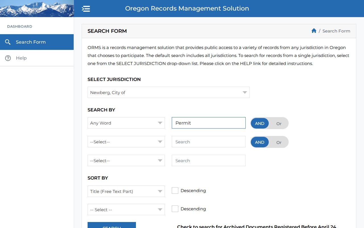
Search Newberg as the jurisdiction, because the wider ORMS system includes more than one Oregon public body.
Newberg Street Directory History
For a historic house or storefront, a reverse or criss-cross directory can place an address before a name-first directory can. The Yamhill County History Museum Research Library holds uneven Newberg city, regional, reverse, and telephone-directory runs. Match the street number to the directory’s publication year, preserve the abbreviation and directional exactly as printed, then compare adjacent years, deeds, maps, census context, newspaper notices, or probate leads. A printed entry is a dated listing, not evidence about the address today.
The Newberg Public Library holds Sanborn editions for 1892, 1902, 1905, 1912, and 1929. They can establish building footprint, street context, and use in a given era, but do not name everyone associated with a property. The historical directory collections belong on the Newberg Directory Book page; use them here as one address-focused layer in a larger record trail.
Newberg Directional Street Variants
Newberg’s current address system uses directional components. City address-assignment documents show examples such as N Page Drive and E Columbia Drive. A 2018 Page Landing notice says an East directional appears on street signs to match City addressing even though an older plat depiction did not show that directional. Historic sidewalk research also found variation in numbered-street notation and suffix punctuation.
Keep the source spelling, then test a second search with or without the directional and with a shortened or fully spelled street type. No official source reviewed established a citywide Newberg renumbering event or a formal conversion chart. When a historic result does not line up, compare nearby corners, buildings, plat context, and the legal description before deciding that two formats identify the same parcel.
Note: A directional difference can be a formatting issue in an older source, not proof that a Newberg property moved or changed hands.
Newberg Streets and Records Geography
A postal Newberg address, a city-limit location, and a county parcel are not interchangeable. Yamhill County assessment and Clerk records reach both Newberg and unincorporated county parcels. City Community Development holds municipal permits, planning, and engineering records only where City jurisdiction applies. The City Limit layer is the right check before requesting a municipal file, while the County Clerk remains the title-record custodian for Yamhill property.
This distinction matters as boundaries change. The City reports ODOT and mill-site annexations approved in December 2021 and effective January 19, 2022. Its 2026 urban growth boundary process may affect future urban geography. A property within the urban growth boundary is not automatically within city limits. Verify the parcel’s current jurisdiction rather than relying on the city label in a mailing address.
Newberg Street Directory Limits
No official source supports a public whole-street or voter roster for Newberg. The address chain can show assessed ownership, tax correspondence, recorded parties, public permit activity, dated directory listings, and legally limited election information. Oregon My Vote is a personalized registration and ballot-status service, not a normal by-street voter browser. Protected voter and Address Confidentiality Program information remains outside public street searching.
Private household composition, utility customer data, and Oregon DMV address data are not supplied as a Newberg street roster. Use a property or historic-record trail for family history, an estate question, civic context, or personal property research. Do not treat a single public field as proof of residence.
Address privacy. Use Newberg address records only for lawful personal, historical, or civic research. Do not use any result to stalk, harass, intimidate, or harm a person, and do not seek protected addresses through indirect record combinations.
The Yamhill County public-records request instructions explain the written fallback for nonexempt County material that is not available through a portal.
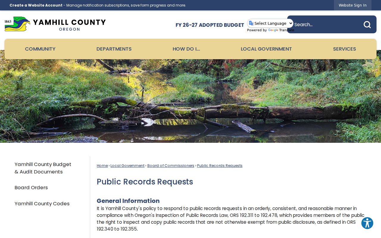
A precise request should identify the holding department, address, date range, and sought record type so the County can locate and review the correct material.